Hiking Sakurajima is a great way to explore the volcanic island. You get a much better sense of the rough nature, and the life the locals live on this ex-island. In this post I share my experience hiking on Sakurajima.
My experience hiking on Sakurajima
I started the day by taking the ferry from Kagoshima to Sakurajima. I had decided to visit the volcanic island without a vehicle of my own. The ferry ride across the bay was quite short, but really beautiful. The volcano rises on the other side of the bay, and gets bigger and scarier the closer the ferry gets.
I hadn’t prepared myself too well for the day. I had a few bottles of water in my backpack, but hadn’t brought any food with me. Luckily I found a Lawsons convenience store near the port when I arrived in Sakurajima. At Lawsons I picked up some food and snacks, and got a coffee to start the trip on.
Hiking to Yunohira Observation Point
Loop lenght: 14.5km / 9mi Ascent: 394m Descent: 394m
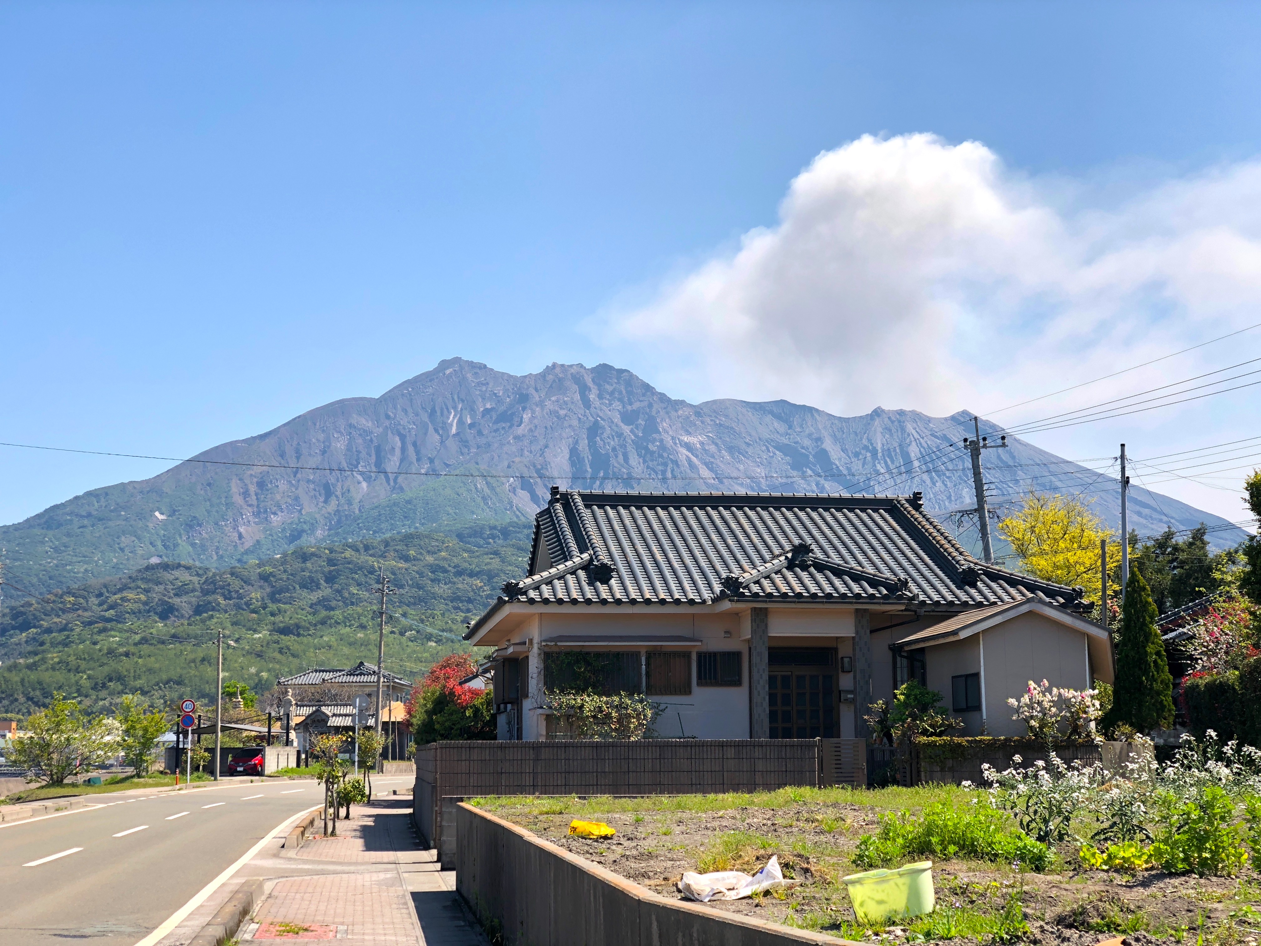
My first destination was the Yunohira observation point. Located at a height of 373 meters above sea level and just 2.5km from the crater it was supposed to be the place with the best view at the smoking action. I hadn’t managed to find much information in advance about getting there by foot. It turns out that you get there the same way you would by car – follow the road. There are no real hiking trails up the mountain on Sakurajima due to the dangerous and unpredictable nature of the place.
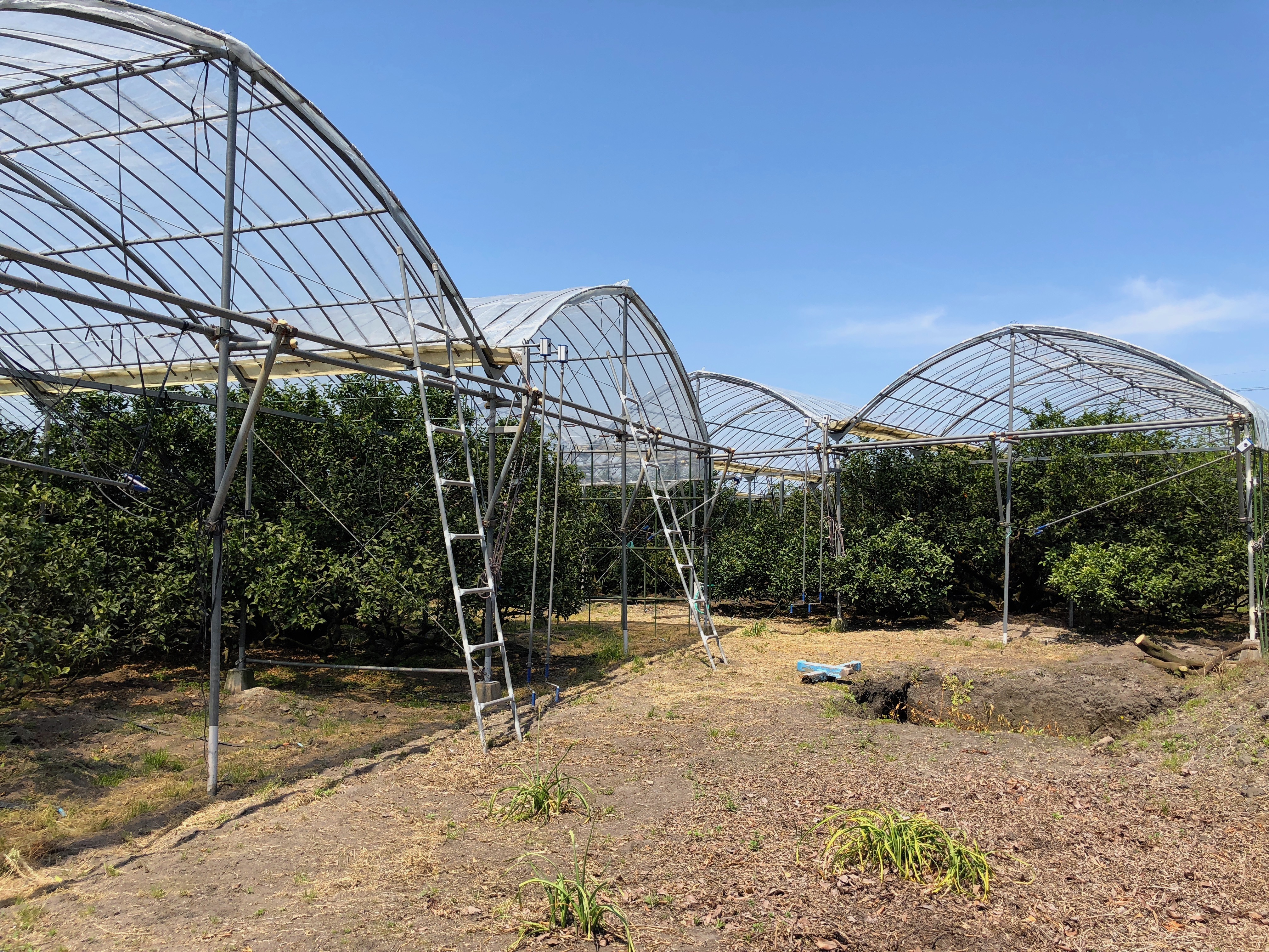
From the ferry port I walked left along the coastal road, through some urban-like area with beautiful ocean view houses. I took a right turn after 1km or so, and the road started to snake its way up the mountain side. I passed some charming orchards where the famous Sakurajima mandarins are grown.
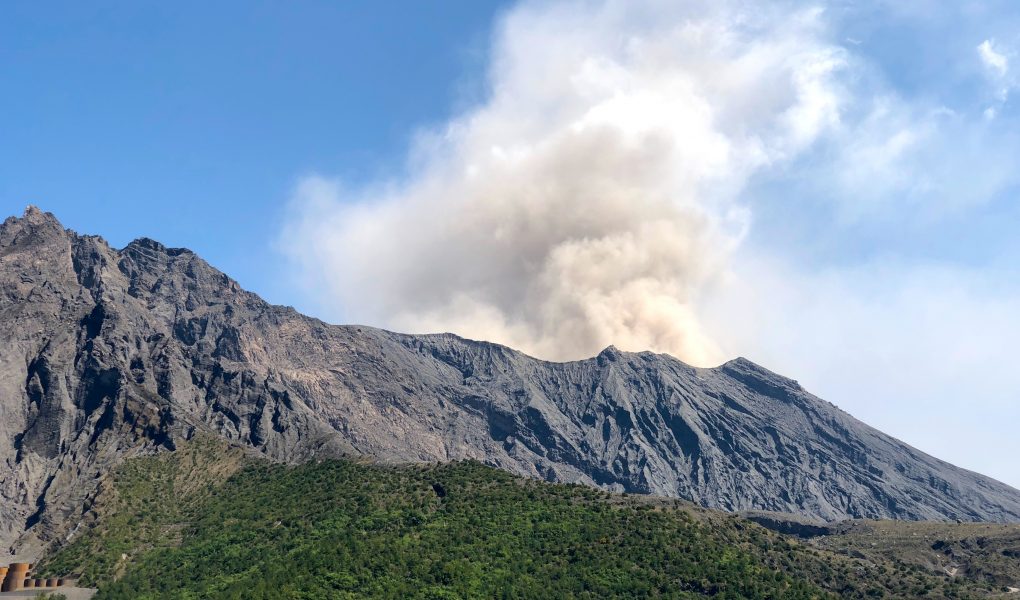
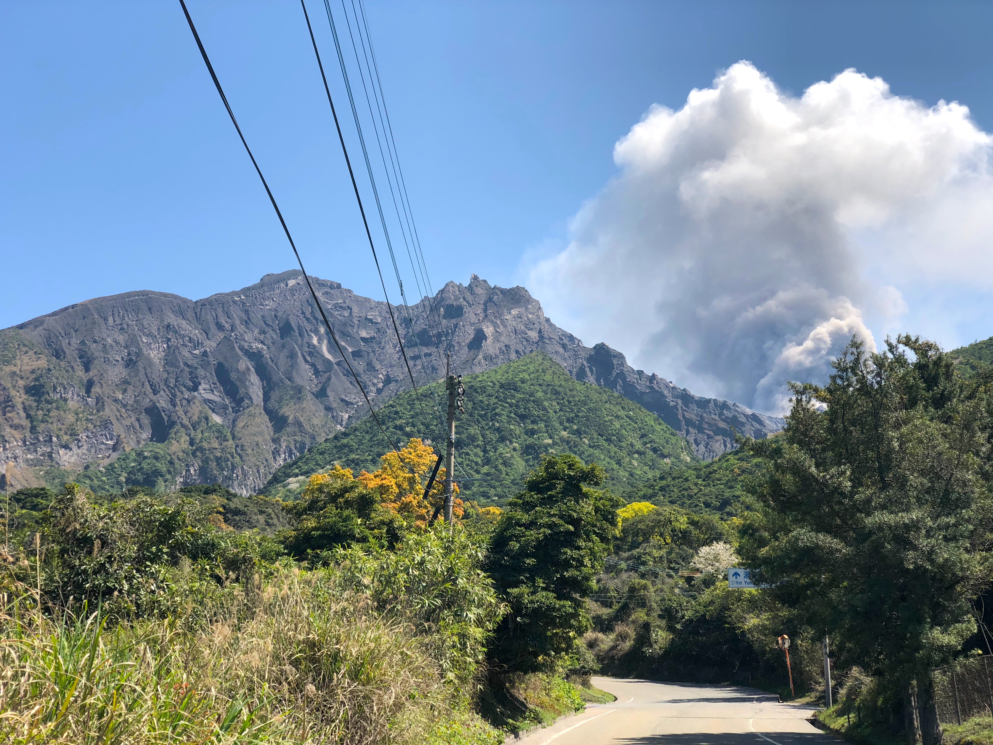
As I continued my way up the mountain road, the smoke from the volcano’s crater seemed to become darker and more intense. I also noticed an increasingly thick layer of volcanic ash on the road and the leaves of the trees around me. I’ve never been on a volcano before, and definitely not an active, smoking one so it really made an impression on me.
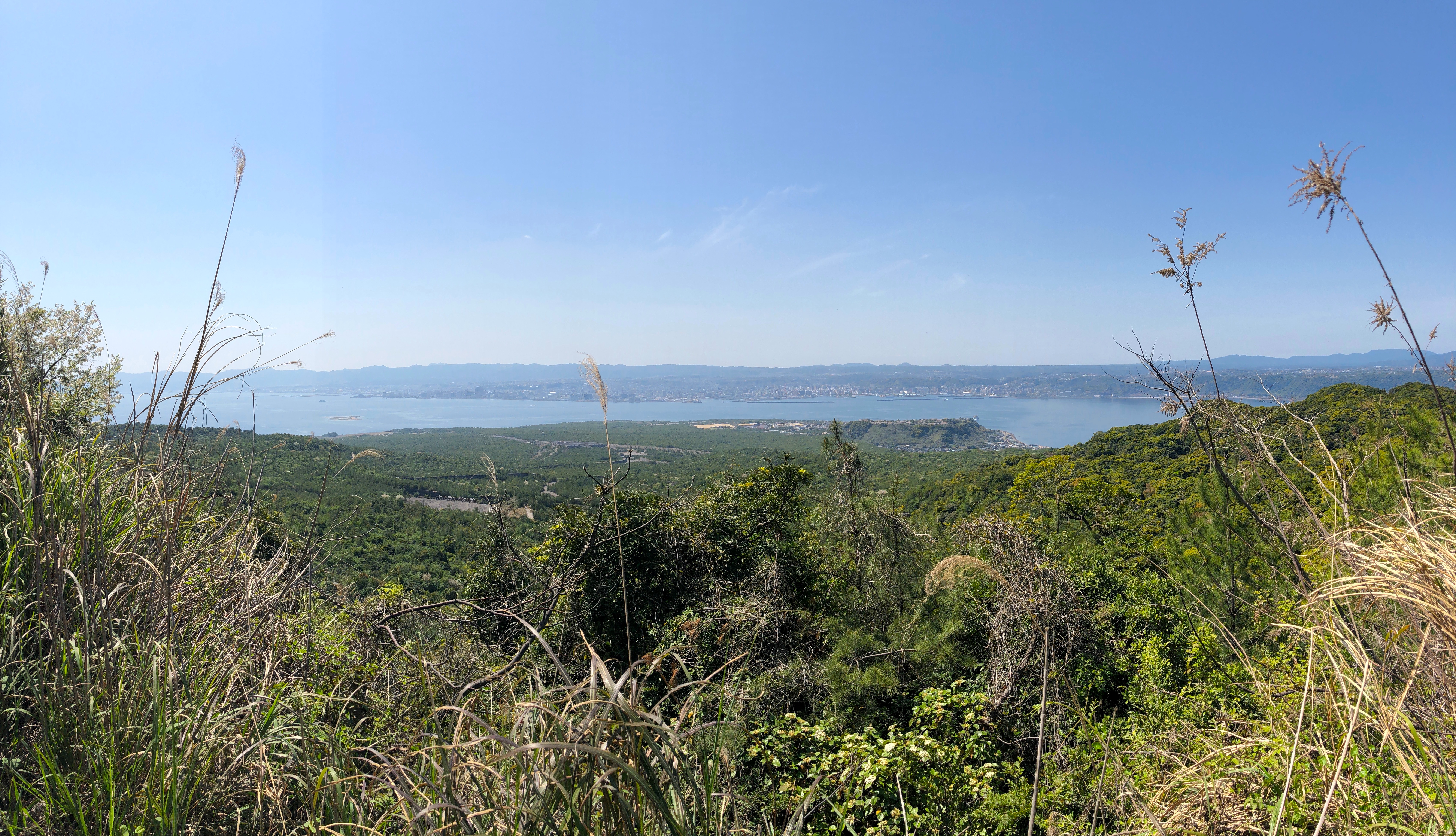
The sun was baking, and my supplies of water had run out half-way up the road. I started fantasizing about vending machines appearing around the next corner – sadly none appeared until I finally reached the observatory. Completely invisible during the hike up the mountain, the observatory is located on the top of a small hill on the mountain side, offering a great view of not only the crater, but the entire western side of the island.
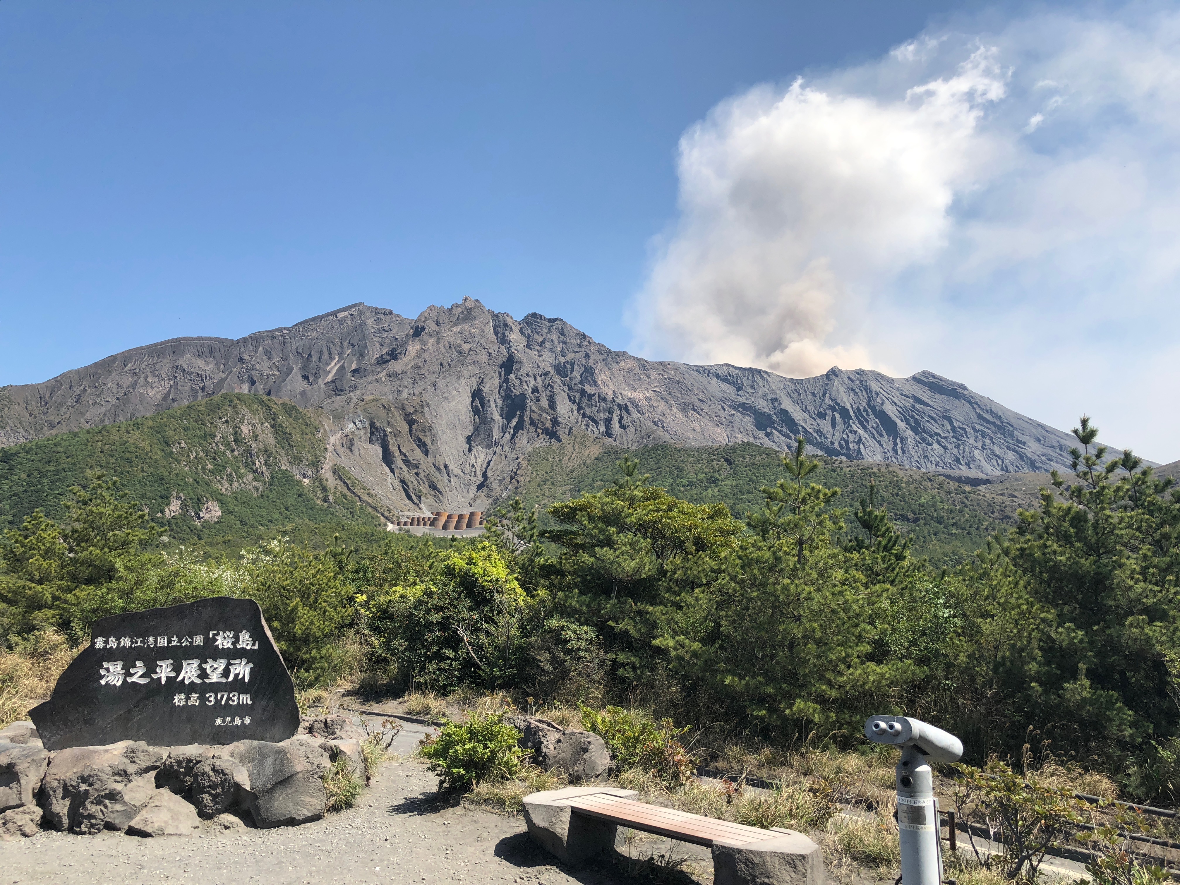
A small shop inside the observatory building sold coffee, cold drinks, snacks and souvenirs. I grabbed an ice coffee from the shop and sat down in the sun where I enjoyed the view for a full hour. The view is truly spectacular, and I couldn’t help but think how small and delicate we are as human beings.
In the morning I had decided that I would hike both up and down the mountain. I quickly realized that the 6km uphill hike had exhausted me more than I expected, so I checked the bus schedule at the observatory. Unfortunately the bus had just left, and the next one wasn’t leaving for another hour. I decided to have another coffee and take this great opportunity to relax and empty the mind in front of the unique view of the volcano. I managed to film some time lapse videos of the volcano – these clips really show how living the volcano is.
There wasn’t much traffic on the way up. I think twice a bus passed me, and maybe once a car. Half way up I encountered two very sweaty tourists taking the hike down from the mountain. I really recommend this walk if you are in a good shape. The intense green colors of the vegetation against the dark lava stone and the slightly unnerving smoking volcano make for an unique experience which you can’t have many other places in the world.
Hiking Nagisa Lava Trail
Loop lenght: 3km / 1.8mi Ascent: little Descent: little
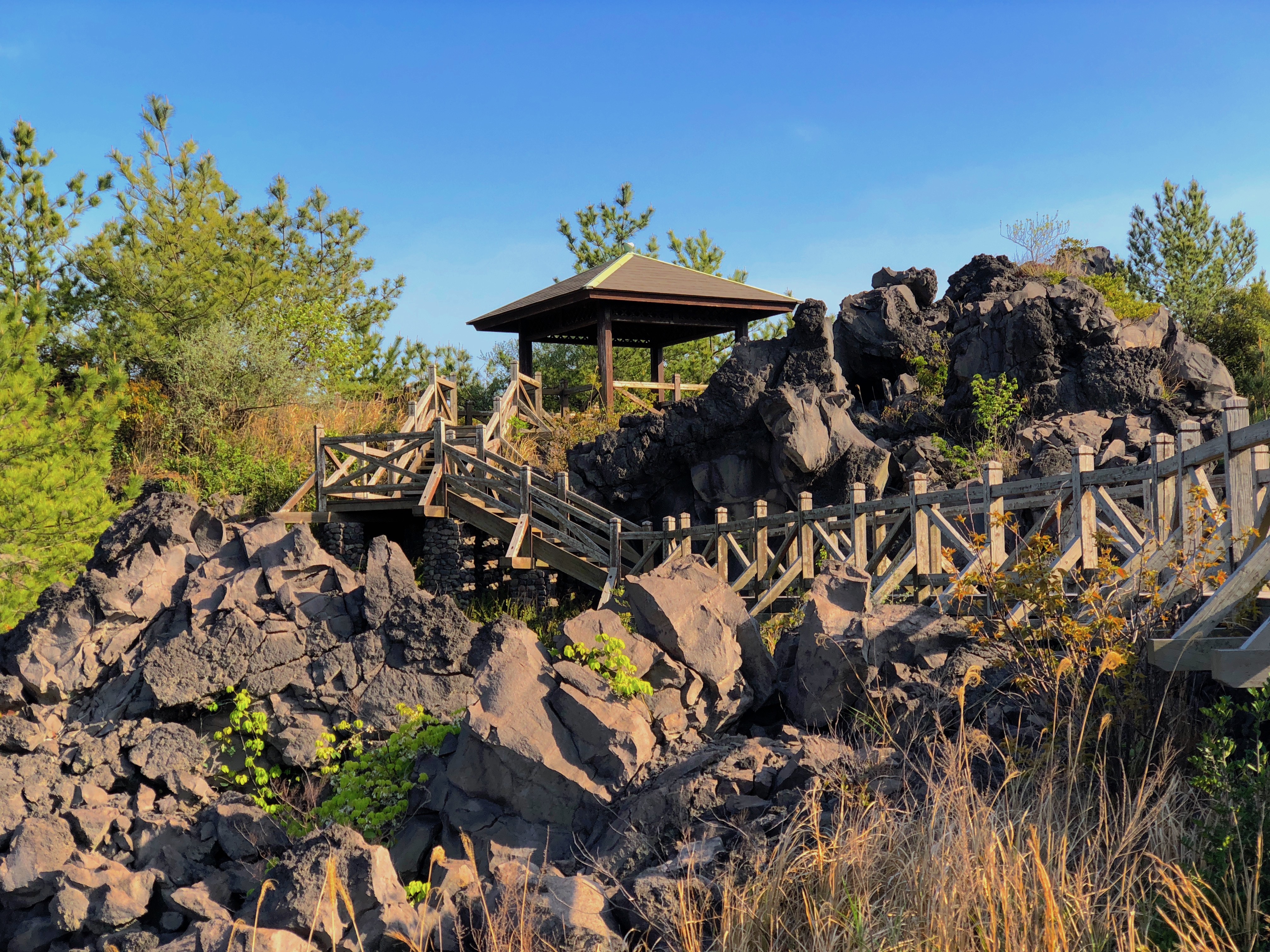
When I returned from my walk up to Yunohira observation point I continued to the Nagisa Lava Trail. The trail head is near the visitor center and foot bath, by the port. A 3km path is laid out through the lava field, and gives a completely different experience of the rough nature than my previous walk to Yunohira. The rock formations are incredible and you get a really good picture of the raw landscape that was created in the large 1914 eruption of the volcano.
The path more or less follows the coast line for a few kilometers, and the landscape changes character from rough and rocky to overgrown and more flat. When I was about 2km out on the path I came across a cat, begging me for food. I felt bad for the little guy, but had nothing to offer. I continued a few hundred meters, and encountered several other cats, then more and more. All aggressively begging for food. Shortly after I reached a public restroom, where someone had left several cans of cat food – well.. that explained it I guess.
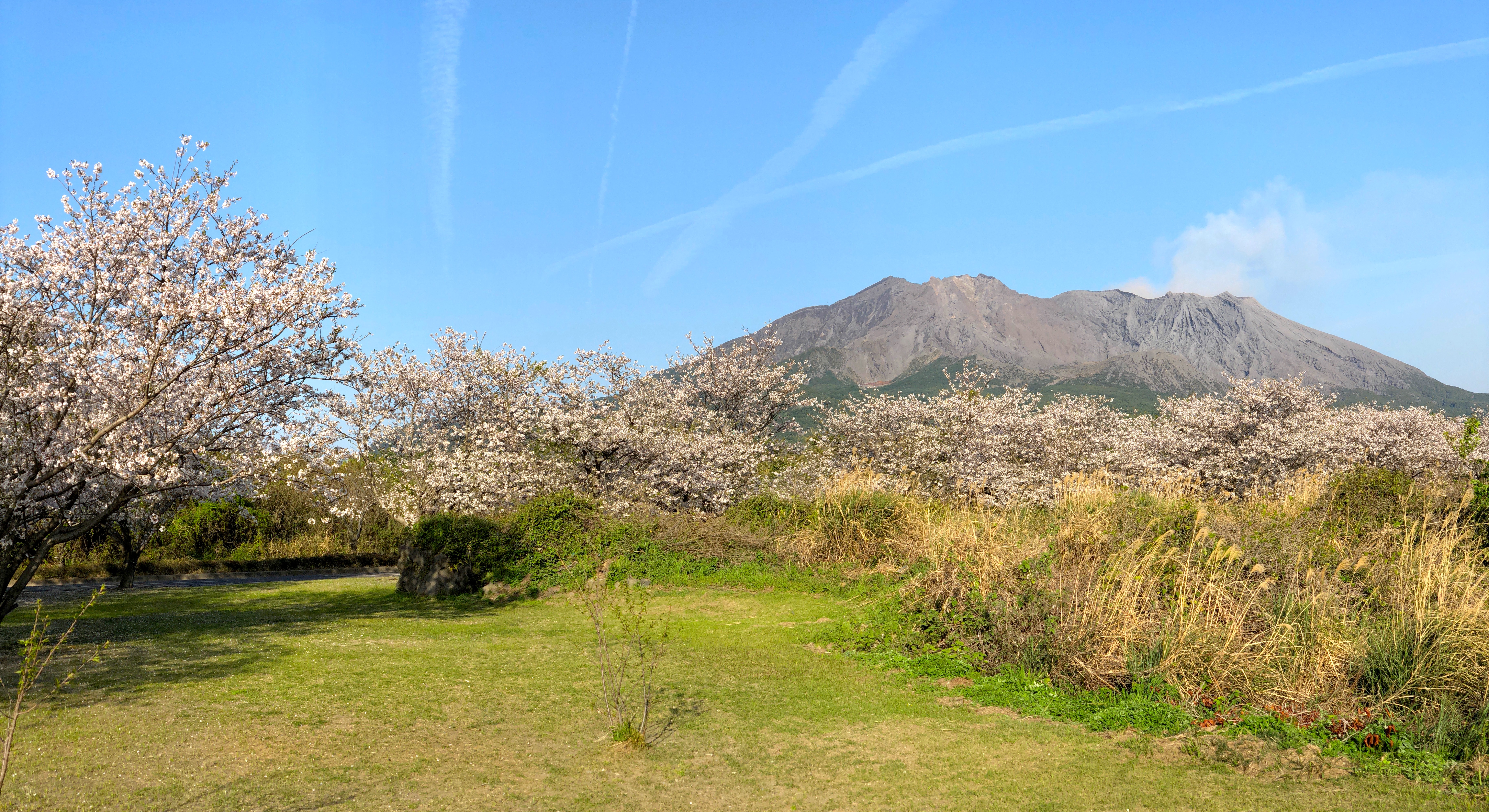
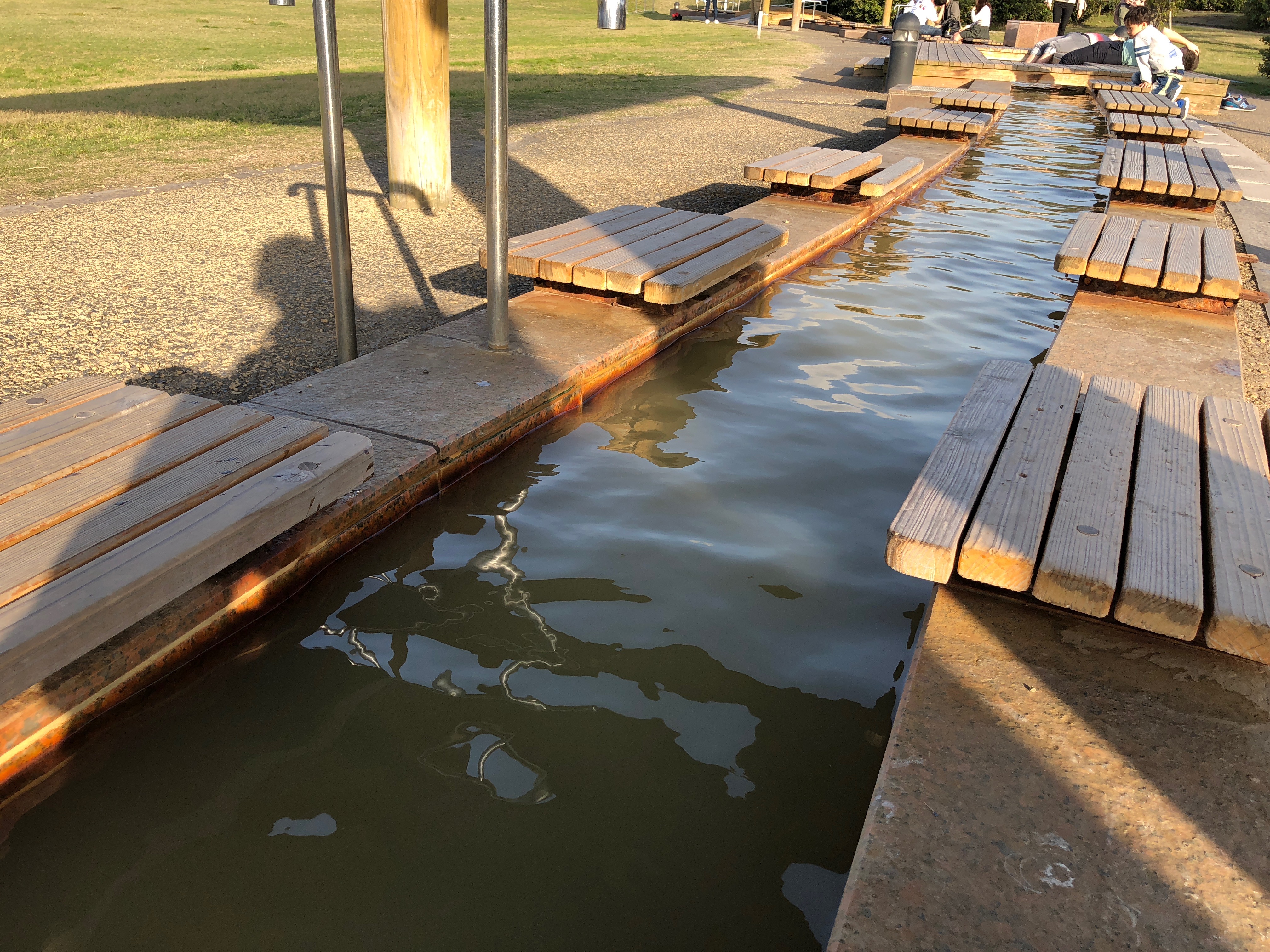
I took a left turn after about 3km and ended up back on the main road. I found myself in the middle of a boulevard of blooming cherry trees. The view was stunning, with the contrast of the beautiful, delicate flowers and the terrifying and dark volcano in the distance. I spent half an hour enjoying the flowers before I continued down the road which led me back to the port area. Here I finished the day with a nice, hot footpath at the free Nagisa Foot bath. A great way to end a great day. Hiking Sakurajima is definitely a must.
Getting there
Read my post about getting to Sakurajima.
I have added a map of the two hikes below. It might be helpful if you wish to do some hiking on Sakurajima yourself. I have a separate post about Sakurajima where you will also find a map of the port area, and information about attractions and busses.
Are you planning a trip to Japan? then you might be interested in finding the best guide books for Japan. While you are at it, i recommend you to check out my post about budget traveling in Japan and the Japan Rail Pass.
For accommodation near Sakurajima check out some hotels, hostels or airbnb apartments in the area.

[…] are a few hikes to do and highly recommended. Check that link for hiking […]